Using urban spatial analytics to solve city planning conundrums
The Weitzman School’s Elizabeth Delmelle, director of the Master of Urban Spatial Analytics program, discusses neighborhood change, urban inequality, and urban transportation.
This summer, geographer and geographic information scientist Elizabeth Delmelle joined the Stuart Weitzman School of Design faculty and became the director of the School’s Master of Urban Spatial Analytics (MUSA) program, which equips students to use geographic information system mapping (GIS), spatial analysis, and data science to address the public policy and city planning conundrums of our day.
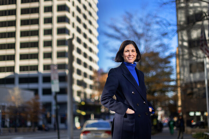
Elizabeth Delmelle, associate professor of city and regional planning. (Image: Weitzman News)
Prior to Penn, Delmelle was an associate professor at the University of North Carolina at Charlotte, where she became an authority on the changing dynamics of the rapidly growing city of Charlotte. Delmelle studies the processes of neighborhood change, urban inequality, and urban transportation.
“When I was doing my dissertation [in geography and urban regional analysis], I really got into looking into other fields, like computer science, for methods that can be used for visualizing and analyzing neighborhood change, which is a multidimensional concept. A neighborhood is not just one thing. There are people and there’s income. There’s crime and there’s housing. I didn’t feel at the time that there were great methods for analyzing these changes across multiple characteristics over time and across space. So, I became kind of obsessed with this quest for methods that could better enable us to visualize these changes and analyze them.”
“Not a lot of people in geography were doing computational and quantitative urban geography … So, I was a bit on my own in the small group of people who were doing this very quantitative and computational work. I found a home teaching in a more traditional GIS [geographic information system] program, where I applied the methods to urban applications—neighborhoods and transportation. The MUSA program is very aligned with what I had been doing and followed the similar trajectory from GIS to more computational methods.”
In additional research Delmelle has conducted, she found that light rail might not be the best investment for helping people get to their jobs. “We have low-income people spread out in older suburban neighborhoods and the jobs that they might want to get to are also dispersed. There’s no mass transit solution currently that will effectively get that population to the jobs they might be interested in at this moment.”
“I tend to be controversial and say you can invest in light rail, and it’s good to think about the future, but that’s not really going to help the low-income population. It’s just going to give more resources to people who already have some. What those neighborhoods need are all of the supporting infrastructure. They need sidewalks. They need to be walkable. They need mixed land use. We need to do all of the ‘boring’ stuff before we can have the cool train.”
Nanoparticle blueprints reveal path to smarter medicines
New research involving Penn Engineering shows detailed variation in lipid nanoparticle size, shape, and internal structure, and finds that such factors correlate with how well they deliver therapeutic cargo to a particular destination.
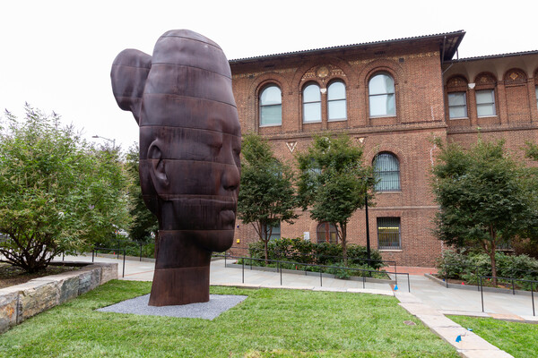
A generous gift from alumni Glenn and Amanda Fuhrman brings the work of internationally acclaimed artist Jaume Plensa to the University of Pennsylvania. The latest addition to the Penn Art Collection expands Philadelphia's public art.
A massive chunk of ice, a new laser, and new information on sea-level rise
For nearly a decade, Leigh Stearns and collaborators aimed a laser scanner system at Greenland’s Helheim Glacier. Their long-running survey reveals that Helheim’s massive calving events don’t behave the way scientists once thought, reframing how ice loss contributes to sea-level rise.

